Mitti Nadi Fm
Type Locality and Naming
SUBSURFACE. Interval 2110-3645 m in Kutch - A well [Original Publication: Zutshi, P.L., Mittal, S.K and Shah, L. (1993) Lithostratigraphy of Indian Petroliferous Basins, Document IV, Kutch Saurashtra Basin, KDMIPE, ONGC Publication, pp 1-50.]
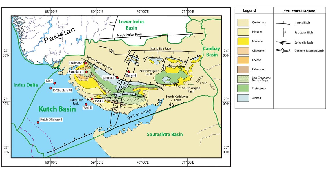
[Fig. Geological and structural map of Kutch, also showing the onshore and offshore wells drilled for oil exploration. (Map by Rasoul Sorkhabi in GeoExpro Dec2014, based on various sources including S.K. Biswas, Current Science, 25May2005)]
Lithology and Thickness
Claystone and Limestone. 1535 m thickness in well Kutch-A. It can be divided into two members:
(i) Lower claystone member: consists of mainly grey sticky claystone, calcareous shale with occasional bends of sandstone, argillaceous and silty,
(ii) Upper Limestone member is consists of chalky limestone with claystone / shale streaks.
Relationships and Distribution
Lower contact
Unconformable with Narayan Sarovar Fm. This also coincides with the bottom of Globorotalia kugleri partial range zone.
Upper contact
Non-conformable with overlying Kandla Fm.
Regional extent
GeoJSON
Fossils
G.kugleri P.R.Z and Miogypsina globulina- M. (L.) excentrica assemblage in well Kutch-A; and large numbers of planktic foraminifera Globoguardrina globossa, G. cf. binaensis and Catapsydrax dissimilis faunal assemblages.
Age
Depositional setting
Lower part of the formation is deposited in middle to outer shelf, and upper part in inner shelf environment.
Additional Information
